
Trip Report: South Nahanni River - June 2013
South Nahanni River
Submitted by Lou Kustin
 In 2013, my wife and I had been retired in the Upper Peninsula near Lake Superior, and we were missing the river rafting trips we had enjoyed in Alaska and Yukon territories. A South Nahanni River trip (referred to as Nahanni) had been tossed around off and on for over 20 years. During the course of 2013 I started the conversation with my wife about having an amazing rafting season, convincing her of the rivers we should include prior to the Nahanni. At 62 and 67 years old we had some concern about the remoteness of the Nahanni. To boost our confidence and refresh our skills we decided to float the San Juan, the Desolation Gray section of the Green and the Rogue rivers before heading to the Northwest Territories (NWT) in June.
To reach the Nahanni takes a bit of planning so I pulled together all the information from previous years of trying to make the trip happen and continued the research. Really, there wasn’t much information on the Nahanni River and most trips that occurred were done with guides. I had gotten hold of an out-of-print book written by Peter Jowett and in that book he referenced a couple who lived on the Liard River as a point of contact. I wrote a letter, but never received a reply. 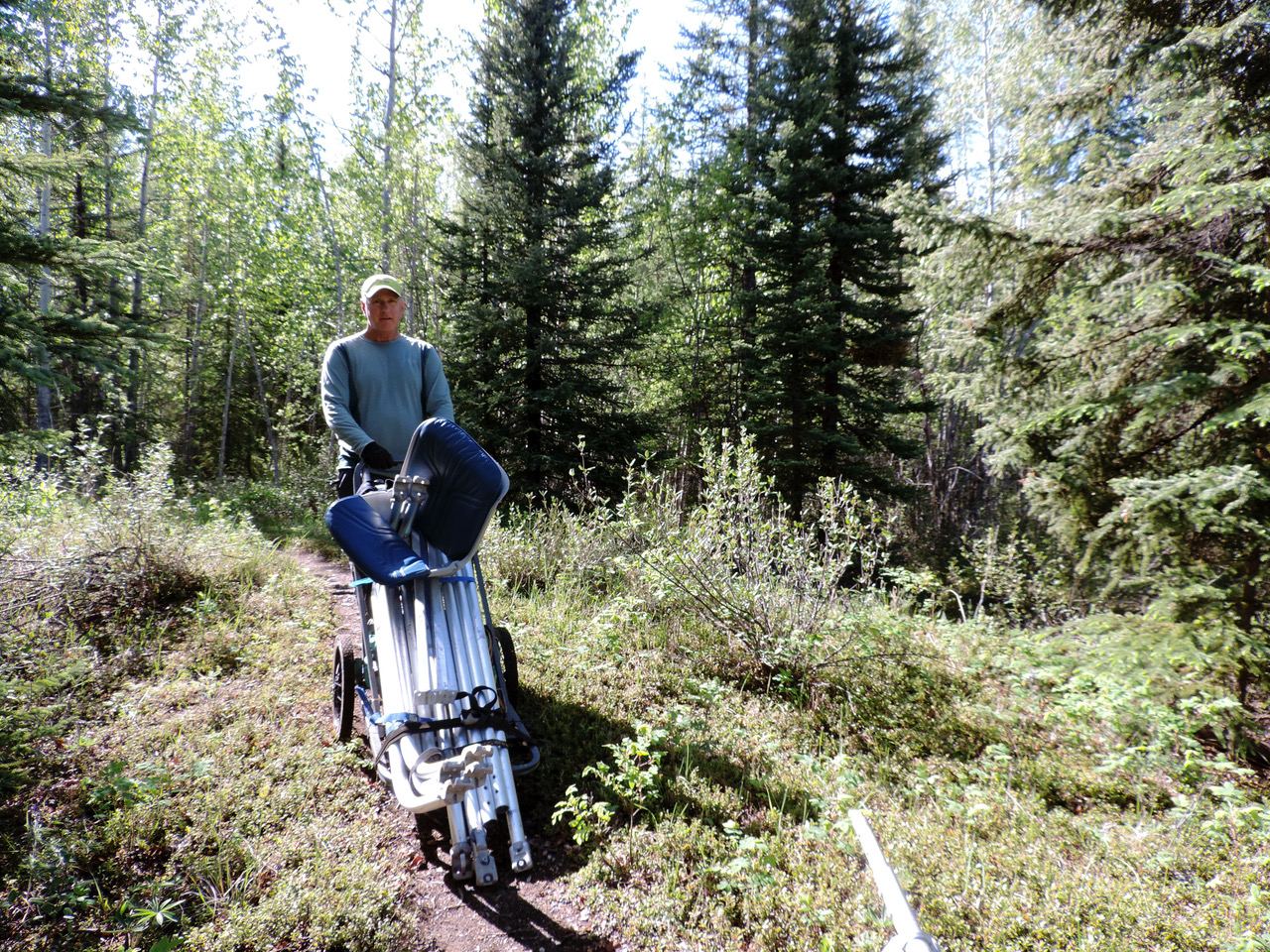 I communicated with the Nahanni National Park Reserve office in Fort Simpson for the permit and whatever other information was available.
Aside from the permit, arrangements had to be made for the charter air service. We worked with Simpson Air based in Fort Simpson. The process included weighing every piece of gear. So full setup was required in the garage before we left, then take down and weighing. We were allowed 1300 pounds including us. I’m a rafter. We take stuff. The final weight before food was 442 pounds. Final transport arrangements would be made in Fort Simpson. We knew there would be one difficult portage.

On the way to Fort Simpson to make the final travel arrangements we drove by a sign for Lindberg Landing which was where I had sent a letter asking for permission to use the location on the Liard River as a pick up and take out location. Turned out that Sue Lindberg never did receive my letter, but was very friendly and accommodating. Although the book I had gotten her and her husband’s names from was published in 1993, Sue was still there living on their homestead. Things were falling into place.
 The trip to Fort Simpson took about three hours on a dirt road and a ferry crossing the Liard where it meets the McKenzie. At Nahanni National Park Reserve headquarters we worked with a ranger to figure out where to launch. The original plan was one portage around Virginia Falls, a 315 foot thundering waterfall split into two main falls by a massive rock named after Bill Mason. We had planned to launch from Honeymoon Lake, but learned getting through the narrow tangle of woods on a creek and pulling over a beaver dam was not possible with a raft. The next logical downriver launch site was Bunny Bar, a sand bar large enough for a Beaver on wheels to land. In mid-June the Nahanni starts to crest, and at 25000 cfs there wasn’t enough bar to land. We decided Rabbitkettle Lake would work out since it was only a one km trail to the main river and still allowed us to see the river and country above the falls. It added a portage, but in the eyes of the ranger we worked with would be a relatively easy one. The flight would take 21/2 hours, 300 air miles from the pickup at Lindberg Landing.
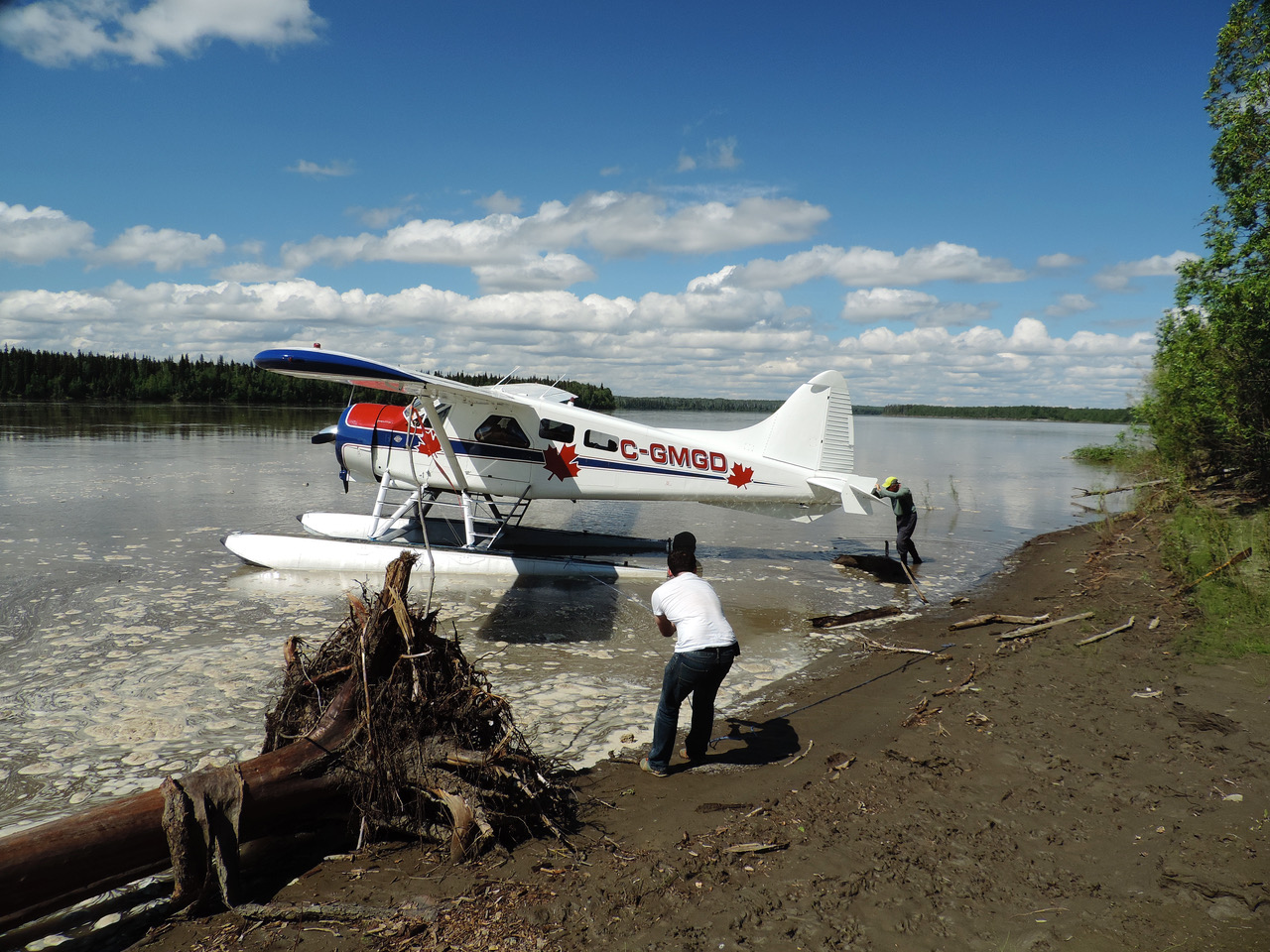
 After our meeting with the ranger at Nahanni National Park Reserve headquarters we headed to Simpson Air to finally meet the people I had been communicating with and drop the gear off. They weighed every piece of gear and neatly piled everything assuring us it would be on the plane. We bought a few groceries, but had planned ahead to go light (really) and eat mostly freeze dried food and baked goods. The plan was for Simpson Air to depart Fort Simpson with all the gear, take the one hour flight to Lindberg Landing, land on the river and ferry up to the bank where we would load the rest of our gear and be off.
The pickup was set for two days after the gear drop. The weather went south on the scheduled pick up day, the clouds and rain moved in no plane showed. The following morning did not look great, but by noon the clouds lifted, we heard the plane at 3 pm. We scrambled to get loaded and on our way by 4 pm. Although a Beaver holds a lot, with all our gear, three people, plus survival gear for the pilot it was tight. The floats were filled with additional fuel, six 20 liter containers, since the distance was beyond the Beaver’s range for the return to Fort Simpson. The trip had come together!
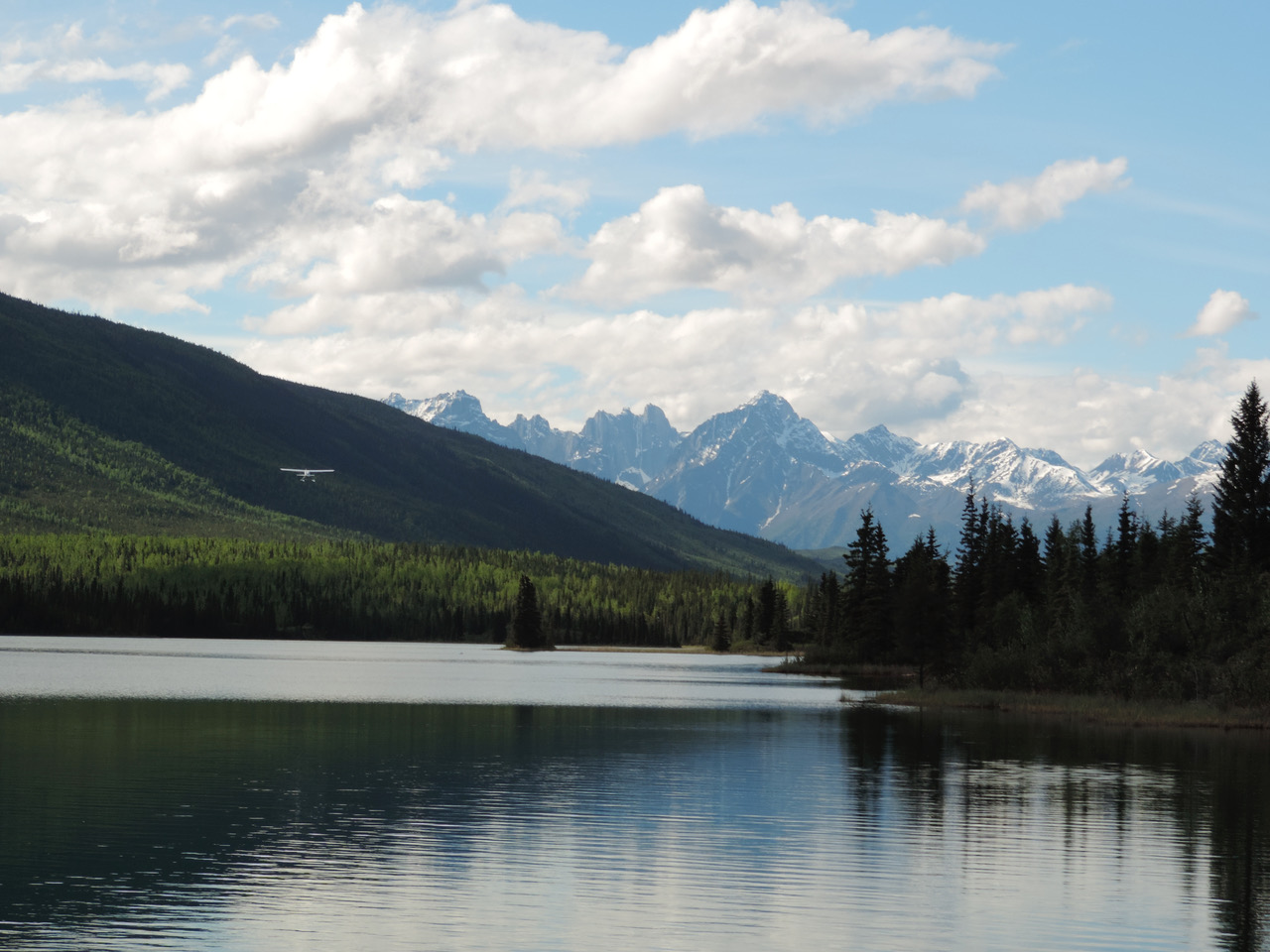
 We flew upriver along the Liard to Nahanni Butte where the Nahanni River empties into the Liard. As we flew into the McKenzie Range the view of the river, expanse of the country and variety of terrain was attention grabbing . We saw the The Splits, the four canyons we would float through and then Virginia Falls. The country opens up after the falls, but the mountains are never that far away. In another 1 1/2 hours we landed at a mirrored surface, postcard perfect Rabbitkettle Lake, blue skies overhead, pleasant temperature. Looming in the distance as we approached Rabbitkettle Lake was the Ragged Range and Cirque of the Unclimbables.
When finalizing the permit, we learned we would be the only people in the 11,602 square mile national park for the first few days. It would be another two weeks before the Rabbitkettle ranger station would be staffed. It was mandatory for us to sign in at each ranger cabin along the way. If we did need emergency assistance we were directed to break into a ranger cabin which was supplied with park radios, emergency locator beacons, first aid kits and basic food items.
It was getting to be late in the day by the time we were unloaded and the pilot drained the fuel into his tanks and took off. I think it was at this point when the remoteness really set in. The ranger cabins were few and far between. We also noticed the triangular shaped metal platform caches were 20 feet above ground, with a skinny ladder and pulley system to hoist the food. The ranger station was covered with plywood and nails pounded from behind and lots of evidence where bears had recently been around the building.
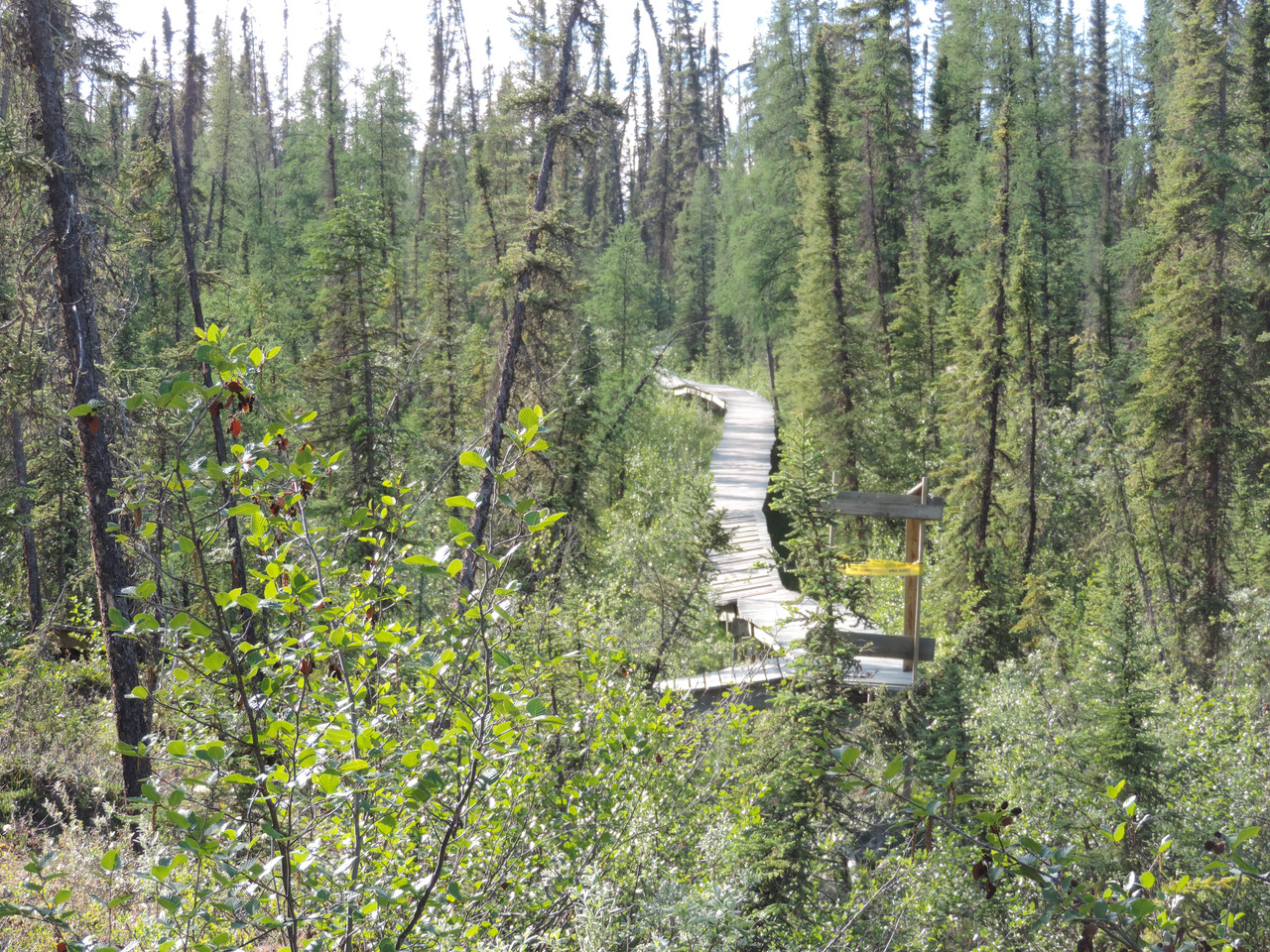
We walked the one km to the river. Up and down, holes, rocks, bushes and at the end was an information kiosk where people who flew in and landed on the river during lower river flow would be introduced to the park. Also another cache tower and a storage shed again with nails pointing out and lots of bear prints. It is the land of the midnight sun, the weather was great so we began the first of seven round trip shuttles. While investigating the trip I learned the guides use carts to shuttle gear at the falls so I brought along a lightweight cart used for deer hunting. It saved us. I could haul the heaviest gear on the cart. We decided to move as much of the raft and gear and leave the food in the cache at Rabbitkettle. We tented in the kiosk on the river bank on high alert for bears. Next morning we ate breakfast at Rabbitkettle Lake watching a loon glide through the perfect reflections, and were startled by a loud “pong” noise. It took a minute to place the sound of fuel barrels expanding in the sun. These were cached for the helicopters that brought summer staff in and out of the park and for emergency purposes.
 The Tufa Mounds are formed at the junction of Nahanni and Rabbitkettle Valleys. There are two mounds each created by a separate hot spring and each one has different features. Both mounds are built of tufa, a soft sandstone-like material consisting of calcium carbonate and are considered rare in the world. Visiting the mounds involves going on a 10 km hike with a ranger. The ranger back in Fort Simpson warned that we should watch for brown bears in that area. They loved foraging for the skunk cabbage that was abundant this time of year. We had already decided we would keep to the river since the high fresh green spring grasses would hide any bears. The Cirque of the Unclimbables is another multi-day trip for some who bring climbing gear and explore. It is the type of trip for a small group, extremely knowledgeable, and fit, since it is demanding hike through thick forest and a faint trail.
By early afternoon on day two we were ready to continue the adventure. We went a short ways and camped on a beautiful sandy bank. It felt so good to be on the water and rested after the portages. The four day float to Virginia Falls was beautiful; heavily forested slopes beneath rugged rocky peaks, braided river channels, clear cold streams sending blue-green plumes into the gray silty Nahanni water. The third night we camped at Hell Roaring Creek awakened to heavy frost in the morning.
We came upon a moose lying on a small sandbar midstream. As we approached, keeping as much distance as we could, it struggled to stand, neck and spine hackles upright, nervously focusing on us. We could see through the binoculars that it had an injury and dried blood on its hindquarters. It didn’t try to swim, just watched warily as we passed. There were bear and moose tracks everywhere. We kept hearing the soft sound of voices drifting from who knows where. The next day we came upon the source, six Tundra swans conversing in soft honks. When we got too close they flew off downriver. We’d catch up, float too close, they’d fly off. It became routine and they stayed ahead of us until we reached the campground at Virginia Falls. Our fourth night we set up camp on a broad sandy beach with long sight distances. The next morning we enjoyed freshly baked muffins with our coffee as we watched low misty clouds drifting down mountain slopes lit by a very pink sunrise.
The evening before we planned to reach Virginia Falls campground we looked into a campsite at Oxbow Lake. The entrance to the lake was about as wide as our raft so that we had to pole our way in. The lake edges were crowded with dark spruce forest. From our maps it appeared the campsite was on the far side of the gooseneck, which meant a long row. A stiff breeze on the south end of the lake added to the work. And as we started to round the bend in the gooseneck mosquito clouds thickened then it started to sprinkle. Maybe it wasn’t such a good idea. We left, traveled maybe another 10 km to Virginia Falls Campground arriving later than we usually got off the river. We welcomed the company of the friendly 12 man, 2 women maintenance crew that arrived that day to do annual maintenance on the boardwalks and helipad.
We managed to get our tent set up on a platform and the sunscreen over a picnic table just ahead of an all night downpour. The entire campground including tent and picnic table pads, out houses and float plane docks is built on and connected by boardwalks to protect the fragile environment from the summer visitors to this world heritage site. The boardwalk to the top of the falls is about 1.3 km, and filled with the roar of the falls. Ahead of the falls the boardwalk splits, the other leg leading another km to the top of the gnarly switchback trail to the bottom of the falls. Along the trails we saw Lapland Rosebay, rare MacKenzie Lady Slippers, Shrubby Cinquefoil, Labrador Tea, Arnica, White Mountain Avens, and lots of Wild Roses.
 The park ranger, Dorothy, and park interpreter, Jerry, who were overseeing the work crew came by our campsite the second and third night there bearing Labrador tea, cake and stories. Jerry brought museum quality props and shared the stories and information about the park and the indigenous people that he presented to park visitors. It turns out that he is a native Dene’ elder and leader and had an audience with Pope John Paul VI in Rome to ask the Pope to keep his promise to visit his people. The Pope did.
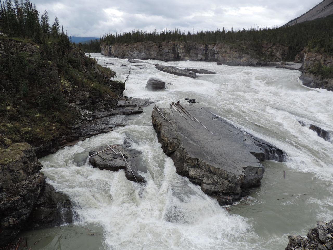
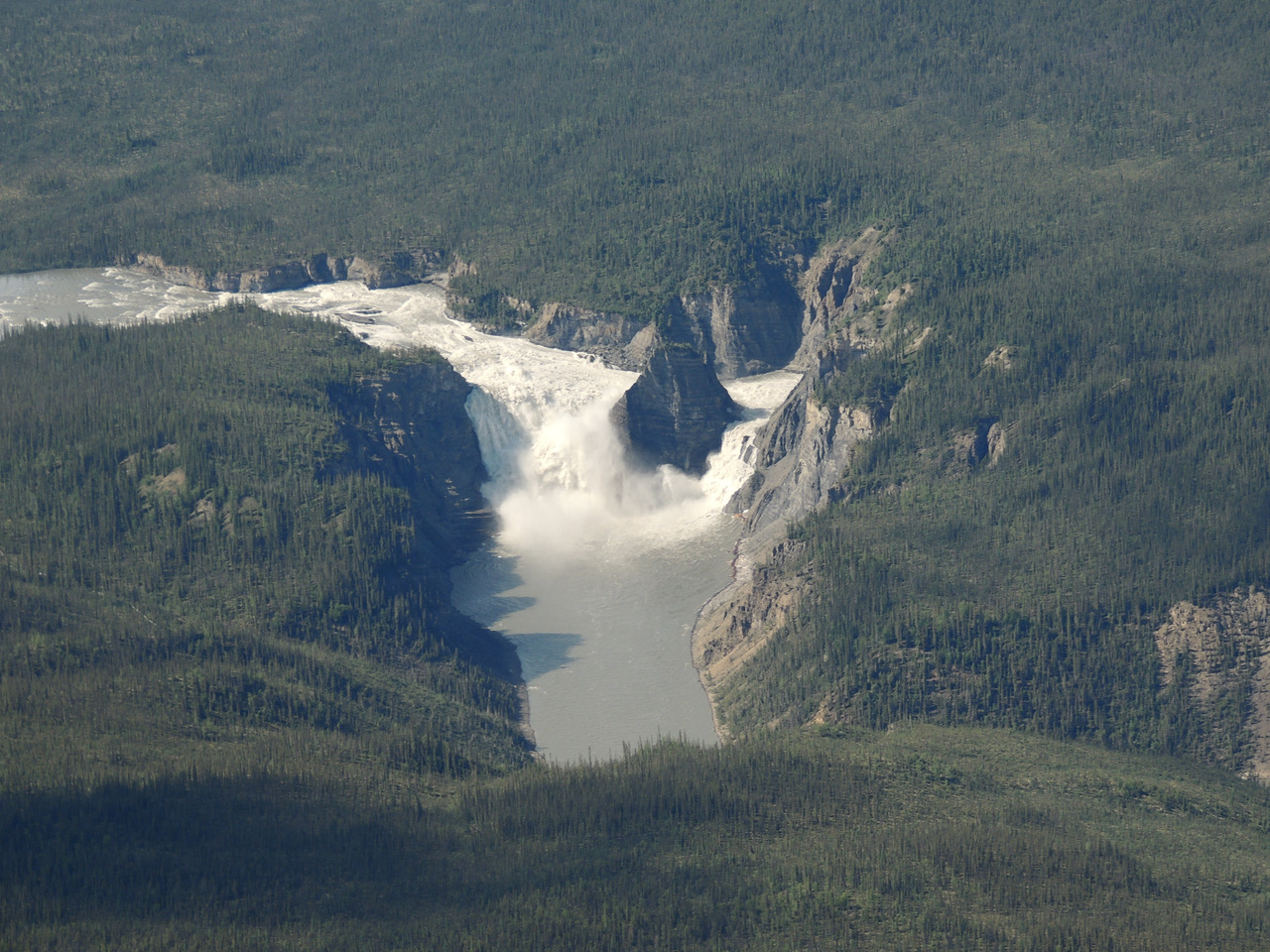
The overlook is humbling beyond words. Immense power, tremendous fury, majestic, deafening, ferocious come to mind and reminded us of our vulnerability and underscore our need to remain cautious and alert. Including Sluicebox Rapids at the beginning of the river drop, Virginia Falls drops 315 feet. In June and July the average volume of water is between 800 and 1300 cubic meters per second - 28,000 to 46,000 cubic feet per second. A tall rock piercing the center of the falls is named after Bill Mason who is a well known Canadian canoeist, naturalist, artist and filmmaker who loved canoeing the Nahanni.

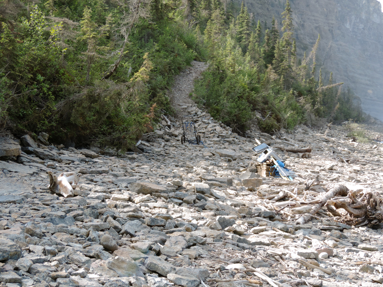
The first hike was to the beach below the falls, the route that we would have to again haul all those loads. We moved our gear via the raft to the portage takeout site about 1 km downstream from the campground. We unloaded all the gear and disassembled the raft leaving our camping gear and some food back at the campground. It was going to take more than a day and that was the only place to camp near the falls. Load after load we “headed over” with the cart as full as we could get it while the other followed carrying as much as possible in arms and on the back. Steeper parts of the boardwalk had “speed bumps”. After the boardwalk ends the trail is a footpath with lots of switchbacks. The last quarter of the trail, the steepest part and sharpest switchbacks, took twice or more as long as the boardwalk portion, letting down the heavy cart, skidding, one of us braking while the other resisted gravity on the front end. On several trips down the cart became too unwieldy. It rolled once and was not easy to right being careful to not break a wheel or axle. We broke up the load leaving gear on the side of the trail until we came back for it. One double back trip the remaining load wasn’t large enough that I needed help so my wife headed up and onto the boardwalk, knowing I would catch up. She encountered a huge black bear stepping out of the brush and onto the boardwalk about 50 yards ahead of her. She immediately sounded the airhorn which sent the bear running away into the brush.
 At the bottom of the falls, a long curved beach provides the only area to reassemble and load the raft for the float through the four canyons below the falls. The copious mist and breezes generated by the magnificent waterfall was at first a welcome coolness after the hard work hauling gear in the sun. The beach comprises a jumble of rocks and chewed up, shredded trees, not an easy place to work. As the day wore on it clouded up. We added layers of clothes to stay warm and dry, so that by the time we were ready to launch we were glad to leave the damp and cold behind. Our food boxes had been cached within an electric fence belonging to a tour operator who wasn’t around yet, powered by 12 volt batteries charged via a solar panel mounted on a post. This was preferable to climbing the 20 foot ladder to the rickety platform cache another 200 feet down the rock and wood debris strewn beach. We had started out from the campground about 9:30 am, all our gear was on the beach by 2 pm. By 5:25 pm we were on our way into Fourth Canyon and the beginning of the most spectacular part of our trip.
The biggest water is early on, about 5 km of class II/III standing waves, whirlpools and strong back eddies in Fourth Canyon followed closely by a short run of class I/II rapids in False Canyon. Reds, yellow ochre, siennas, orange, lavender grays color the rugged canyon walls. In that kind of light it doesn’t matter where you point your lens, the colors are saturated. We pulled off the river just above Third Canyon. Barefoot and in short sleeves we set up our tent on a beautiful sand beach well above water level, downwind and on the downstream end of a river island. Eventually it clouded over and then began to rain so we battened down the hatches, tucked into the tent for a well earned good night’s sleep after the energy drain of the long and strenuous day, our spirits renewed by the splendor we were immersed in.
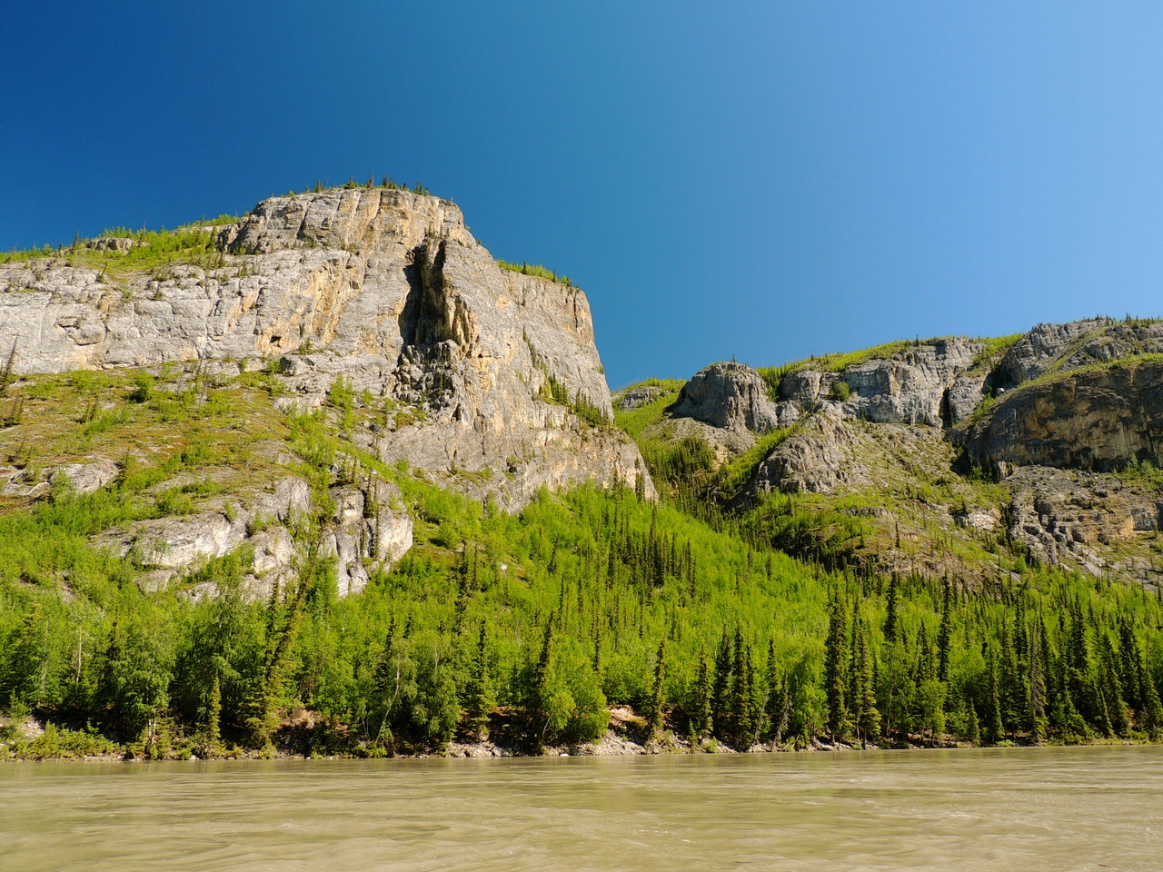
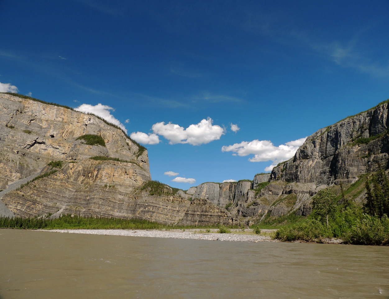
There was overnight heavy rain, by the time we got up it was still overcast, drizzly and windy. We bundled up, reorganized the raft, packed lunch and snacks then headed into Third Canyon which starts with a series of rapids; Wrigley, Whirlpool and Tricky Currents. The ride through the canyon is 35 km of breathtaking neck craning scenery. Bare gray granite peaks above bright yellow-green budding deciduous forest interspersed with dark evergreens form the backdrop for the unusual geologic formations that line the river. We quickly floated past vertical cliffs and cobble strewn beaches at the alluvial fans of tributary rivers. At The Gate the canyon narrows and squeezes the river around a 180 degree bend, walls rise vertically 1500 feet. Where the river doubles back in its direction stands aptly named Pulpit Rock. We pulled off the river ahead of the monolith and scouted for a campsite. It would be a fun area to explore. But we aren’t satisfied, too dark, too wet, too buggy and too dense to allow any sight distance to watch for bears. This early in the season the barely recognizable trail to the top of the Pulpit isn’t any more inviting. So we pressed on looking for a sandy island or open sandy beach where a breeze will keep the bugs away and we can see long distances. It was around 9 pm before we found a beach that wasn’t all large cobbles and boulders, beyond Big Bend, above Second Canyon. The sun had been out for more than an hour. We had traveled almost 70 km.

Funeral Range, Vampire Peaks, Headless Range, Deadmen Valley, Hell Roaring Creek, Sunblood Ranger Cabin - who came up with these names and why? These names speak to the early days of miners and trappers, many who perished, some under suspicious circumstances, and the difficult country that surrounds the Nahanni Valley. We camped just downstream from Warden Valley Ranger station, one of four registration stops. If a group fails to deregister at the scheduled end of their trip, a search party is sent out and the registration helps narrow the search. We woke early to fog and heavy dew on the tent. As sun rose we enjoyed fresh baked muffins and a warm campfire while the fog dissipated in swirls of golds and pinks. We planned to hike to Painted Rocks Canyon, a hike we felt was open enough to scan for browsing bears. We quickly discovered several stream crossings in cold, fast running, thigh deep water that ran through alder thickets and along cobble and boulder strewn river banks. We decided the risks weren’t worth the look. An accident here could quickly change our adventure into a survival effort. We also passed on a hike at Prairie Creek where the alluvial fan braids through more large cobbles and boulders. We mention these spots because hiking has always been an integral part of any river trip and sorely missed these chances to see country beyond the river, but so thankful to just be where we were.
 We traveled through Second Canyon’s sheer rock faces, treed mountain slopes, pocked limestone, waterfalls, ice still clinging to shaded canyon walls, mixed forests of spruce, tamarack and deciduous trees. Following the swift waters of the canyon the river widens significantly, slows, braids, and is filled with big tree trunks and stumps caught in shallow water and on sandbars. The current meanders and sends you back and forth across the river trying to avoid back eddies and strainers and sweepers. The sweepers pick up a rhythmic bouncing drumbeat from the current that we can hear long before we see it. We camped on a sandbar just downstream and in sight of Sheaf Creek Forestry Cabin, our third registration site. The beautiful old log cabin stands high above a back from the river at the edge of the woods. We chose the sandbar over the field in front of the cabin because getting there required hauling camping gear up a tall ladder.
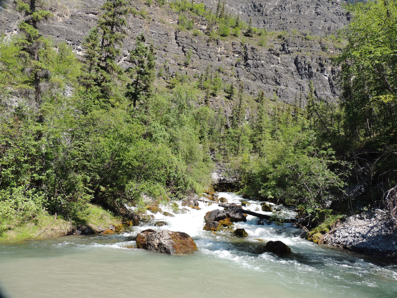
First Canyon, Whitespray Springs and Kraus Hot Springs were ahead. We enjoyed an absolutely stupendous float through First Canyon. By far this is the most beautiful canyon. We were on the river about 12:30 pm, off by 4:30 pm. We stopped at Whitespray Springs where a roaring creek of icy cold, pure, clear, delicious water shoots out of the base of a talus slope below a high sheer wall of rock. We filled every container we could find. About 8 km further downriver we arrived at Kraus Hot Springs. You can catch the sulphury odor before seeing the plumes of cloud rising from the river bank. The first thing we did was strip and slip into the blue green hot pool, our first bath since our showers at Hell Roaring Creek. A rock dike along the rivers edge catches the hot water seeping from a long stretch of bank covered in a fine reddish grass. We pitched our tent in a picturesque setting atop the bank at the edge of a field filled with garden parsnip, pink fleabane, yarrow, sweet vetch, red and sweet clover with a view over the hot pool and river to lavender gray and ochre rock walls beyond. Behind our tent there is one small building left standing where hundreds of miniature paddles, oars, and notes inscribed with names of paddlers and dates of travel hang from the rafters and cover the walls and door. We left our info on a piece of bark hung with the others. Our minimalist mindset said don’t lug everything up the bank so it’s freeze dried dinner, water heated on the Whisper-lite stove at waters edge. We followed a trail behind the shack leading to two more hot springs but the trails petered out in dense alder brush.
The first day out of the canyons where the country again opens up with expansive views clouds piled up then disappeared on a hot sunny day. Slow current through the splits and maneuvering around mass quantities of sweepers, strainers, trees and river debris piled in shallows made the distance so much longer. Around KM 545 we came into wide sweeping goosenecks with virtually no current and no campsites after the splits. We were committed to another long day of rowing. The terrain is unexciting with occasional glimpses of the mountain ranges we‘ve passed through. We saw Wood Bison swimming or standing like statues on sand bars. One resting on the edge of the river waded in and swam in front of us downriver past the village of Nahanni Butte, now visible ahead. Most of the wildlife we encountered were a couple varieties of flies. Dozens stayed with us all day, buzzing our heads, occasionally lighting long enough to take a swipe. The largest ones are called bulldogs locally. Their bite hurts.
Nahanni Butte is a native village with streetlights, four wheelers, boats, kids and dogs keeping hours with the northern summer sun. We were supposed to deregister here but no one was in the office, no phone in sight although there’s a phone number posted. There’s a mowed patch of grass for tenting but no toilets, no privacy. No one is at the store/coffee shop, and no one to ask but a couple of kids who were curious but not helpful. We decided to camp on the river island just downriver from all this activity. The beach is covered in bison tracks. Hopefully they won’t join us tonight.
We fell asleep early to the sound of rain on the tent. About 3:30 am my wife was awakened by strong wind rattling the tent and blowing fine grit under the rain fly and through the tent screens. She brushed at her pillow finding it was coated, as was her sleep- ing bag, face and hair. She could feel the grit between her teeth. I sat up to ask what was going on. My wife burst out in laughter as the exposed half of my face was plastered gray, the other half normal. We both had a hard laugh. The sky was pink, air was warm, so we got up, packed and slowly headed for the confluence of the Nahanni and Liard Rivers. There was no current so the first 5 km was hard work. Slowly Nahanni Butte and the mountains faded away. The Liard is HUGE. High clay banks line the river topped with black spruce and scraggly cottonwood. Except for a few goosenecks there is slow current although you have to row to stay in it as it meanders from side to side. Seven hours later we arrived at Blackstone Campground where the caretaker let us use his satellite phone to deregister with the park service. In another hour we were back at Lindberg Landing where we spent the rest of the hot afternoon and evening dismantling the raft and packing for the trip home.

We had a shared dinner at Sue’s joining her and friends Pam, Theresa and John for pork loin, carrot salad, lungwort (chiming bell) greens, and masaman made with chicken bouillon, Russian blue potatoes, onion, and our contributions of reconstituted coconut cream and coconut milk. There was a pineapple, cool whip, jello pudding dessert, with tea and fantastic company. Everything an all-around hit. We left Sue a couple bottles of Whitespray Springs water, a local treasured treat. John recited a poem from the Rubaiyat of Omar Khayyam. Pam talked about her upcoming boat trip on Great Save Lake, and Theresa kept us laughing with her continuous conversation. Mosquitos were thick.
 It had been a gorgeous trip overall, but much more strenuous than we bargained for. Had we known we might have been better prepared for no current in meanders, the lack of services at Nahanni Butte, the killer portages, the hikes we wouldn’t take, the amount of rowing required, and the gear we could have done without. Then again we may not have done the trip and not known the beauty and wonders of the Nahanni River. We met wonderful “Northwest Territorians” at Fort Simpson, Lindberg Landing, Blackstone Campground and the work crew and park employees at Virginia Falls, and many more. There are many side stories and other adventures within the adventure that are stories themselves. After many years it has been fun for us to revisit what for us was a trip of lifetime. To do that again, ourselves at this stage of life, probably not. Sue has become a lasting friend and someday we would be happy to see her again.
Photos: all photos submitted by Lou Kustin