Trip Report: Combo Main/Lower Salmon River - Aug 2021 - Very low water
The Grand Salmon
Submitted by Rebecca Post
In starting a story about a river trip, where do you start? The conception of the idea? The day you apply for a permit? The day you launch? Well, I have a friend who drew a Main Salmon permit for August of 2020. With COVID running strong and the ability to roll the permit to 2021our group decided to wait for 2021. In the fall of 2020 I did do a two boat float on the Lower Salmon where my buddy and I discussed joining the Main permit with the Lower section and running the fifty or so miles between the Main’s Carey Creek take-out and the Lower’s Hammer Creek put-in. We bounced the idea off the permit holder and some of the other participants. The permit holder, Joyce, was a thumbs up, but several of the other folks could only get time off for the Main (poor working stiffs). So it was settled that a larger group would do the Main and a then a subset would continue on to Heller Bar on the Snake.
 I had run the Main and the Lower three previous times (separately). I had no clue of the waters between Carey and Hammer. Little did I know that the Bureau of Land Management (BLM) has a guide book that covers the river from Carey Creek all the way to Heller Bar. But fortunately my trip mates did and they all had the guidebook. I felt kind of like a rookie. Duh, do some research. (The Lower Salmon River Boating Guide, Vinegar Creek to Heller Bar, BLM).
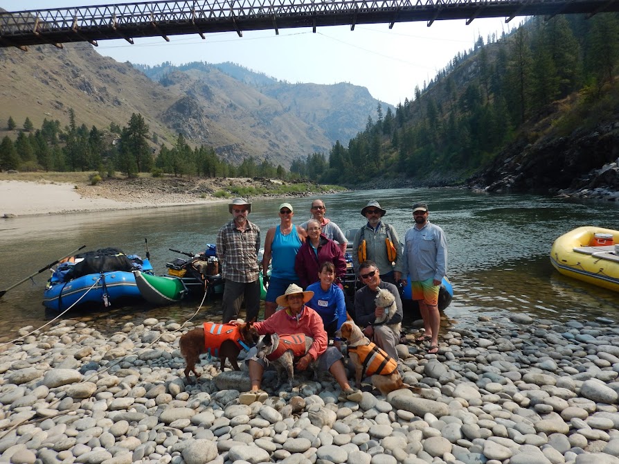
We launched on August 19th. That was set by the permit. In our planning session we discussed being off the Snake River for the Labor Day Weekend because of the insane jet boat traffic we would likely encounter. This made or take-out day fixed to September 2nd. We had 80 miles to do on the Main, then 21 miles to Shorts Bar near Riggins for resupply, another 35 miles to Hammer Creek to pick up our lower permit and then 53 miles of the remaining Lower Salmon and 20 miles on the Snake River to Heller Bar. 209 miles in 15 days (14 nights).
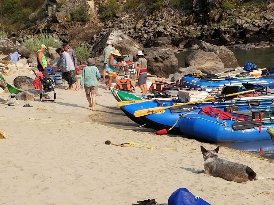
There were logistics as well. We had two rigs (four people) leaving at Carey Creek. Full toilets had to leave and clean toilets had to join the trip (or toilets can be emptied at the Hammer Creek RV dump). Trash had to leave (or can wait for Hammer Creek). Water had to be refilled (Hammer Creek) and ice needed to be resupplied as well as some basic food stuffs. We decided to have one rig go from Corn Creek to Riggings (Shorts Bar) to help with resupply and then get shuttled to Heller Bar. Three rigs had to go from Corn Creek to Heller Bar. We ended up using two different shuttle companies (All Rivers for the Riggins resupply rig and Central Idaho Idaho Shuttles with two different trip leaders Carey Creek and Heller Bar groups) and it worked out just fine.
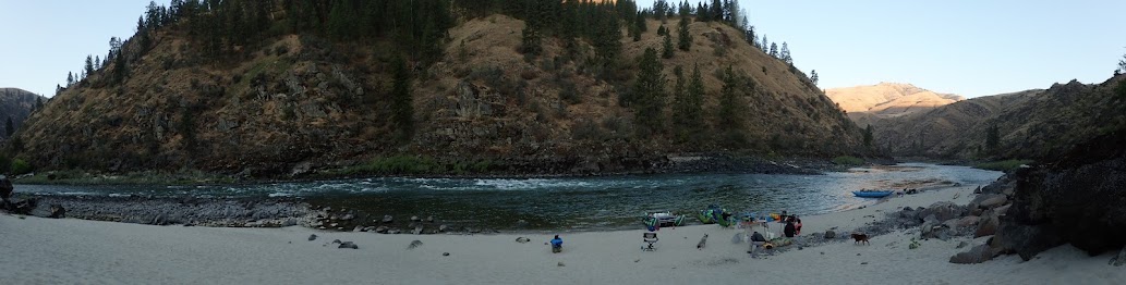
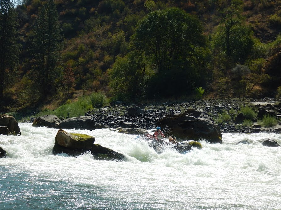 On the Main we had reserved camps for nights 2, 4 and 6. We stayed at camps Lower Lantz (RM 11.2 R), Hancock (RM 26L), Upper Yellow Pine Bar (36.5R), Paine Creek (RM 49R), Upper James Creek (62.2L), Johnson Creek Bar (62.2L). Upper James Creek was a very nice sandy beach with so much room. Having Johnson Creek Bar as a reserved camp on our last night meant we had no pressure trying to find a camp relatively close to the Carey Creek ramp. We launched at 36 inches below the shoes, a true ELF trip. But then we had a good rain on night 2 and all the side creeks really came up. Events of note were the stops at the developed Hot Springs near Barth (RM22.4L) Campbell’s Ferry and Jim Moore’s place (RM 43.1) and of course Buckskin Bills (RM 53.5L). Black Creek Rapid and Vinegar were the biggest water. Elkhorn Rapid was my favorite because the water was moving slow enough you could eddy out and really move into whatever position you needed to. The air quality was fabulous considering the proximity to fires and earlier reports of smoke impacts.
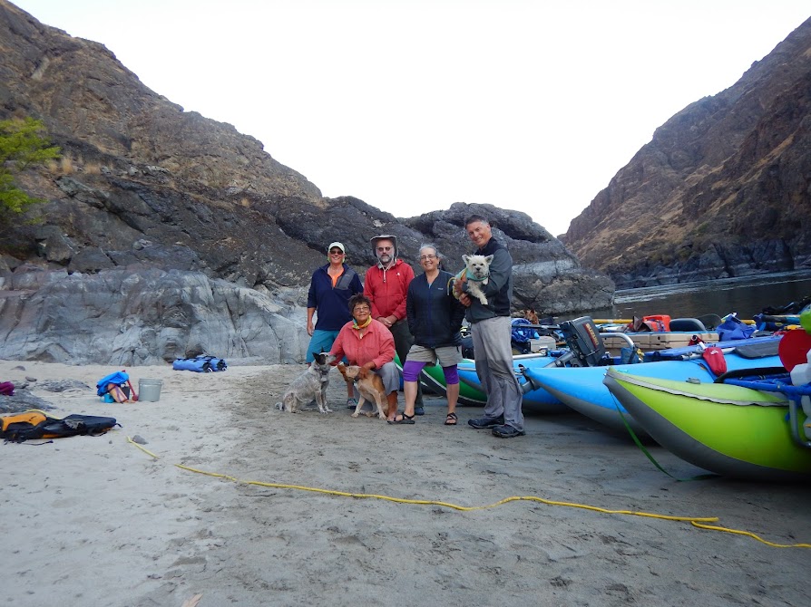
After dropping off our short timers, the remaining five of us, in four boats (three cats and a raft) headed on downstream. While helping our friends at the ramp, a commercial trip came in and found out we were continuing. They gave us all the block and cubed ice they had in their five rafts. We were ice rich!! We took on two clean toilet tanks. We had Chamberlin Gulch in mind for a camp as it was furthest downstream that was still opposite the road. We ended up staying at a beach on river right at 101.9. There was plenty of room for us, the upstream winds had kicked up and we were ready to get off the water. As we lounged around camp, another large group of rafters, that had launched with us at Corn Creek, came floating by. Many boaters were not in PFDs and the parties had started in several of the rafts. One raft fetched up on an exposed rock right across from the lower end of our beach. They were pretty hard aground on the rock and several of their buddies tried to pull them off to no avail. They finally put on their PFDs and two guys got out of the raft and pushed and pulled it off the rock. The rest of the party had landed on the beach below them on river left where they spent the night in a long loud party. We were sure hoping they were taking out at Spring Bar. We passed them in the morning on our way to Shorts Bar near Riggins and never saw them again.

The river from Carey Creek to our camp was moving water with a few slack areas with high canyon walls. The water goes still and winds can really funnel through, usually going upstream. Ugh. Between our 101.9 camp to Shorts Bar there were two class 4 rapids. Ruby Rapid is in the most gorgeous canyon. The walls appear to be polished gneiss with black and white banding that goes all the way up the canyon walls at a 45 degree angle. The boulders are huge and also have the black and white banding. The water level was very low so we got a good idea of what a pourover/hole ridden place this rapid could actually be, without having to run it that way ourselves. The second class four was Lake Creek Rapid. It is located under a yellow bridge and looking back on it, a scout from that bridge would have been prudent. Our 18’ cat led into it, running right of a giant house rock on the left. We saw the back of the tubes up high in the air as he went straight over a huge pourover and bent back the front tubes on that house rock. I was the next boat and that line just did not look good for my 14’ raft with me and three dogs. I chose to go left of the house rock, even though I could not see what was behind it. It was a clean run. Me and the two following cats were grateful.
 After rowing a few more miles of flat water we reached Short’s Bar (RM88L), near Riggins. The shuttle company (All Rivers out of White Bird) had filled up the cooler with block and cubed ice. We seemed to have more ice than room but we made it all fit. Two folks went into town to do some shopping (bread and fresh veggies). The rest waiting at the beach just upstream of the ramp. We camped there with no hassles. There was a vault toilet there so no groover was needed. And several trees made for good afternoon shade. Across the road was an elk farm and we listened to elk mewing all night.We got an early start (the entire trip we were on the water between 8 and 8:30 PST. It had to get light enough for us to see to make coffee and breakfast.) Our next objective was was Upper Blackhawk camp at RM 69L. We were along the highway now and wanted to spend only one night hearing road noise. There is a fun day run in Riggins with multiple class 3/4 rapids. We ran them all and enjoyed the gradient for the first half of the day. Rapids of note were Time Zone (RM84.3) and Traps Creek (RM 81.3). Just pay attention. The bridge at Lucile was a treat. It looks like a little mystery of two bridges in one and is worth investigating. Beyond Lucile the gradient flattened and we started really working. Eight miles of pretty flat water in the afternoon. Good workout. There was a nice beach at RM70L, Box Canyon, that would be a great camp. On river right there is a rock outcrop that kind of shields the beach from the road. Upper Backhawk, our destination, was just a mile further and we opted to row to it to have that one more mile under our belts. It turns out that most of the traffic ends around ten pm and doesn’t start up again until six am.
 We ran Blackhawk Rapid first thing in the morning, right into the low angle morning sun. Fortunately the lead boat gave us a great line to follow because it was really hard to see. This was our most difficult day of rowing flatwater but also a very interesting day of passing agriculture land, mining dredges, opulent homes, and parts of the historic Nez Perce National Historic Trail. I remember looking back upstream from the wide valley we were in, towards the canyon we had emerged from, thinking how far we had come. As opposed to the wildlife on the main (mostly bighorn sheep) we were now seeing lots of deer. We made it to Hammer Creek in good time. We picked up our permit, dumped trash and dog poop, filled our water jugs and were off. We went three more miles to Big Rock (RM50.1L). A great camp with a good swimming beach.
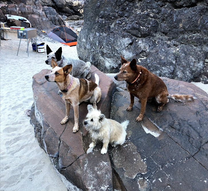
Our camps on the Lower were Big Rock (RM50.1 L), Lower Packers (RM33.3R), Deep Creek (RM20.7R), and Upper Wapshilla (RM8.5L). All of these camps had excellent swimming beaches. My dogs especially liked Deep Creek because they could wade out onto the sand bar quite a ways before having to actually swim. It was my first time at Deep Creek and it was possibly my favorite camp of the trip. Although Upper James creek was a great one on the Main.
Our river running was impeccable on the Lower, especially when one of our boat captains volunteered to lead the route through Snow Hole and then started too far left. The following boats made the correct adjustments and all came through unscathed. We took time to visit some pictographs (RM 45.3R) and rock house ruins at the China Rapid scout (RM18.9L).
 Our final camp was on the Snake River at Lower Cook Creek (RM183.5L). The Snake River presents challenges because of the dam releases which cause the water level to fluctuate, leaving boats stranded on beaches or pounding up against rocks all night. At Cook Creek we devise a system of anchoring the boats out by the stern to keep them off the beach as the water came up during the night. It worked quite well. Did I mention that we picked up a motor in Riggins? Our 18’ cat boat had a 4 hp outboard. We now rigged this. There was some idea exchanges about the best configuration with the four boats but we settled on the 18’ in the middle with a 14’ cat and 16’ cat on either side and the raft nestled into the front tubes pointing forward. But when we came to rapids we let go the formation and ran the rapids solo. Those rapids were the ones following the Cache Creek pool, China Garden, Shovel Creek, Wild Goose, and Deer Head. A group that launched the day after us had camped a couple miles upstream of us at Geneva Bar. They passed us while we were launching and setting straps for the motor out. We passed them once, but they were relentless in their desire to get to Heller and passed us as we rigged and unrigged for the rapids. We ended up at Heller Bar at the same time, but we were not as exhausted as they were.
So there is the trip. A few nights of Thai curry, Fresh fajitas with river-ritas, homemade strew, lasagna, egg rolls in a bowl, BBQ chicken sandwiches, Chicken salad on crackers, Tasty bites Indian food, tamales, and more. All great meals. Super company, nine to start with and five to end with. The four dogs made the entire 209 miles without an involuntary swim from a boat. I hope others will read this and think about enhancing their main permit and extending their trip. I would certainly do it again, perhaps with higher flow.
Photos submitted by Rebecca Post